
The mySmartApp Geofence Solution
When you’re at anchor, knowing your GPS position is one thing.
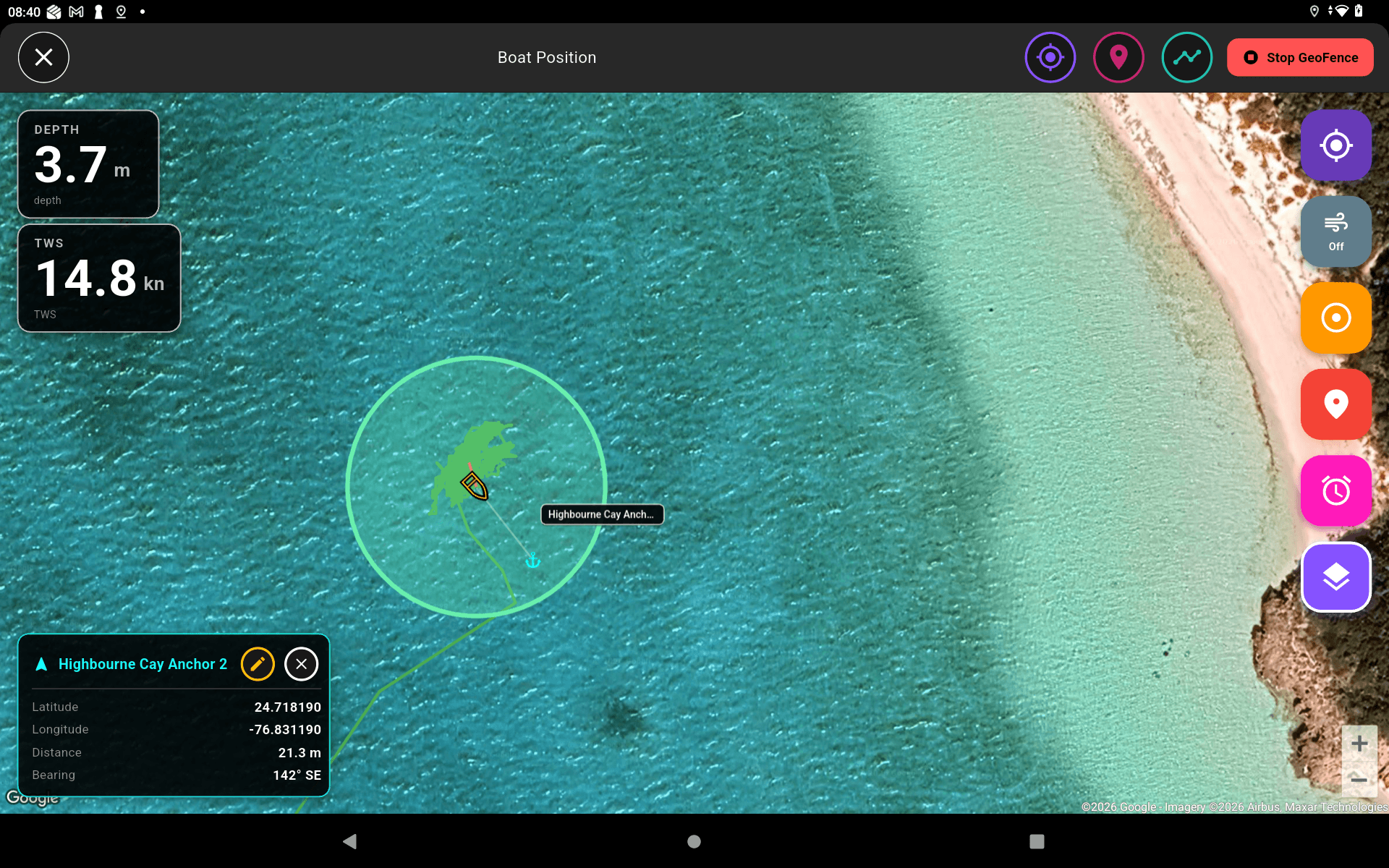
Seeing your boat’s position overlaid on a high-resolution satellite image of your exact location is something else entirely.
mySmartApp combines intelligent geofence monitoring with detailed satellite imagery.
Unlike traditional anchor alarms that rely on coordinates alone, mySmartApp gives you an immediate visual understanding of your surroundings, making it easier to assess your position, monitor changes and make confident decisions at a glance.
Charts tell you where you are. Satellite imagery shows you what’s around you.
No interpretation. No guesswork.
Just a clear visual representation of your surroundings and exactly where your geofence is positioned.
If your boat moves outside your defined safe zone, mySmartApp instantly alerts you, helping you identify potential anchor drag before it becomes a problem.
What you see is what you get.
The confidence of visual reassurance combined with the security of intelligent geofence alerts.
Smart monitoring. Smarter boating.
#onescreentocontrolthemall #SmartBoat #mySmartApp #BoatTech #MarineElectronics #BoatAutomation #YachtTechnology #BoatingLife #SailingTech #NMEA2000 #SmartBoating


